Graham Parkes

Retired Park Manager & Firefighter

Category: Croajingolong National Park

  • Exploring Wingan Inlet

    Exploring Wingan Inlet

    The sometimes dusty, sometimes muddy road from the Princes Highway leads to one of East Gippsland’s most remote and undisturbed coastal locations. Quiet and peaceful, Wingan Inlet in Croajingolong National Park is a welcome destination in our hectic world. 

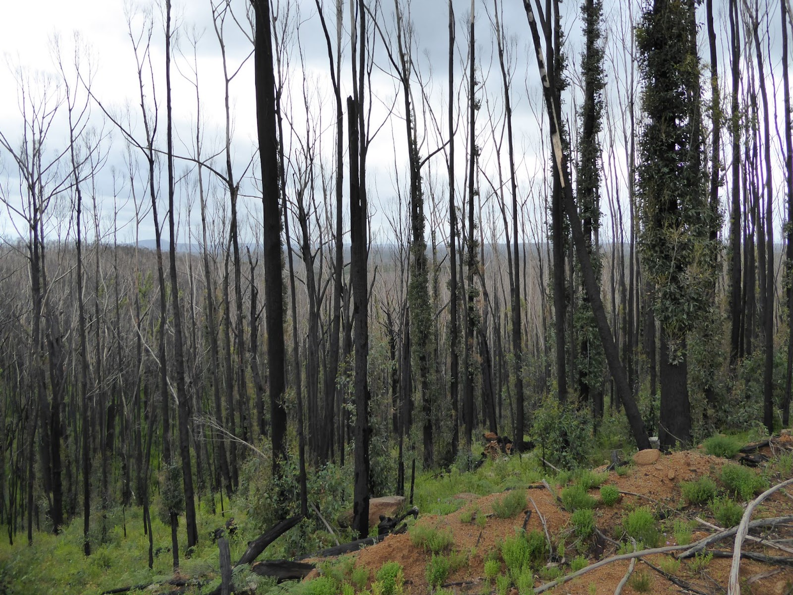
    At the end of the West Wingan Road, on the western shore of the inlet, modest camping and day visitor facilities are found in a setting of large, old Red Bloodwoods (Corymbia gummifera). Wingan Inlet is the most southern natural occurrence of the species.

    Swan Bay – Wingan Inlet

    This is a remarkable place to camp. Wrens, robins, honeyeaters and tree creepers are common. A male Satin Bowerbird sometimes raids camps for small blue items to decorate his bower to attract females. The Kookaburras can be overly dependent on campers’ food and need a watchful eye. Lace Monitors cautiously move through the campground flicking their long tongues at anything that may be edible and are ready to scurry up the nearest tree when disturbed. Occasionally a Red-bellied Black Snake will seek out sunny patches under the Bloodwood canopy. 

    As celebrated by Slim Dusty’s,  “When the Currawongs Come Down”, Pied Currawongs spend the winter among the Bloodwoods, feed on Blue Olive Berry (Elaeocarpus reticulatus) and return to the mountains in the summer. 

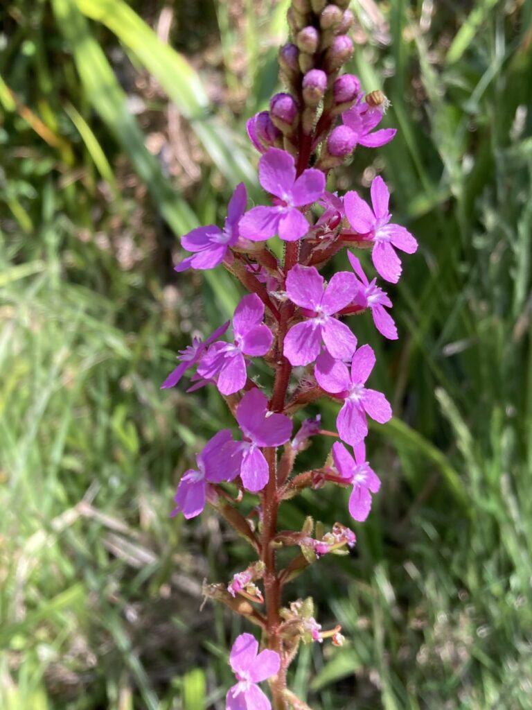
    Plant species flourish in the deep sandy soils through the campground, such as the Giant Trigger Plant (Stylidium laricifolium), and the delicate climber, Bearded Tylophora (Tylophora barbata). 

    After dark Yellow-bellied Gliders screech as they glide from one Bloodwood and scramble up the next. They feed on the Bloodwoods, creating a v-shaped groove in the bark with their incisors to encourage a flow of the bright red sap. Weighing no more than about 40 grams, the Eastern Pygmy Possum feeds on Banksia nectar and pollen and is much harder to see.

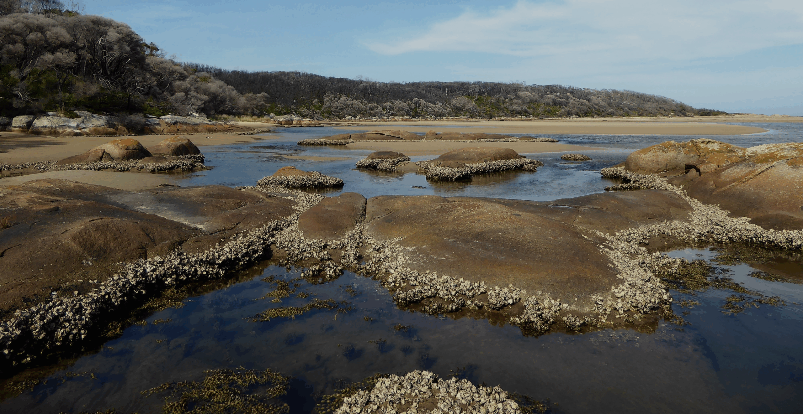
    The estuary is only a short stroll from the campground. Twice each day the tides pour through the entrance, fill the channels, cover the sand flats and then recede.  Many species are well adapted to this continually changing environment. 

    At low tide the Soldier Crabs move en masse across the sand, presenting a formidable sight to potential predators. When under threat, they spiral, out of sight, into the sand.

    Club Mud Whelks, hardy molluscs, are continually on the move on the sand flats, whether the tide is in or out. As the tide flows in, the Australian Ghost Shrimps or Bass Yabbies become active, using pleopods on their abdomen to push water from the burrows to the sand surface. This action enables oxygenated water to move through the burrow. 

    The long, slender Shorthead Worm Eel remains buried in the sand flats during the day with only the tip of its snout protruding and hunts for invertebrates at night. The bony tip of its tail allows it to quickly burrow into the sand tail first. 

    Rich in diversity, the fish life in the inlet include Luderick, Dusky Flathead, Silver Trevally, Estuarine Perch, Black Bream, Australian Salmon and Tailor. In recent years fish more common in northern waters have been seen in the inlet, such as Tarwhine.  

    As much of the inlet is shallow, the best way to explore is by kayak or canoe. The return trip to The Rapids at the end of the tidal section is about eight kilometres. Azure Kingfishers fly from shrub to shrub along the shoreline looking for small fish. White-breasted Sea Eagles  soar overhead to spot larger fish.  

    Heading upstream, Silvertop Ash (Eucalyptus sieberi) and Mountain Grey Gum (Eucalyptus cypellocarpa) dominate the ridge tops, while in the shelter of the gullies, Large Kanookas (Tristaniopsis laurina) draped with vines and creepers grow in the warm temperate rainforest. While the rainforest can appear to be dense and formidable, the vegetation under the canopy can be open and relatively easy to walk through.

    Kayaking near the inlet’s entrance requires an awareness of the tides to avoid being caught in the strong outgoing flow. Inside the entrance, the incoming tide provides good swimming water. 

    From the eastern side of the entrance it is possible to follow the rocky shoreline to Easby Creek, a small estuary which is mostly closed, about a five kilometre return walk involving some rock scrambles. The return day walk further east to Red River requires careful consideration of tides and weather.

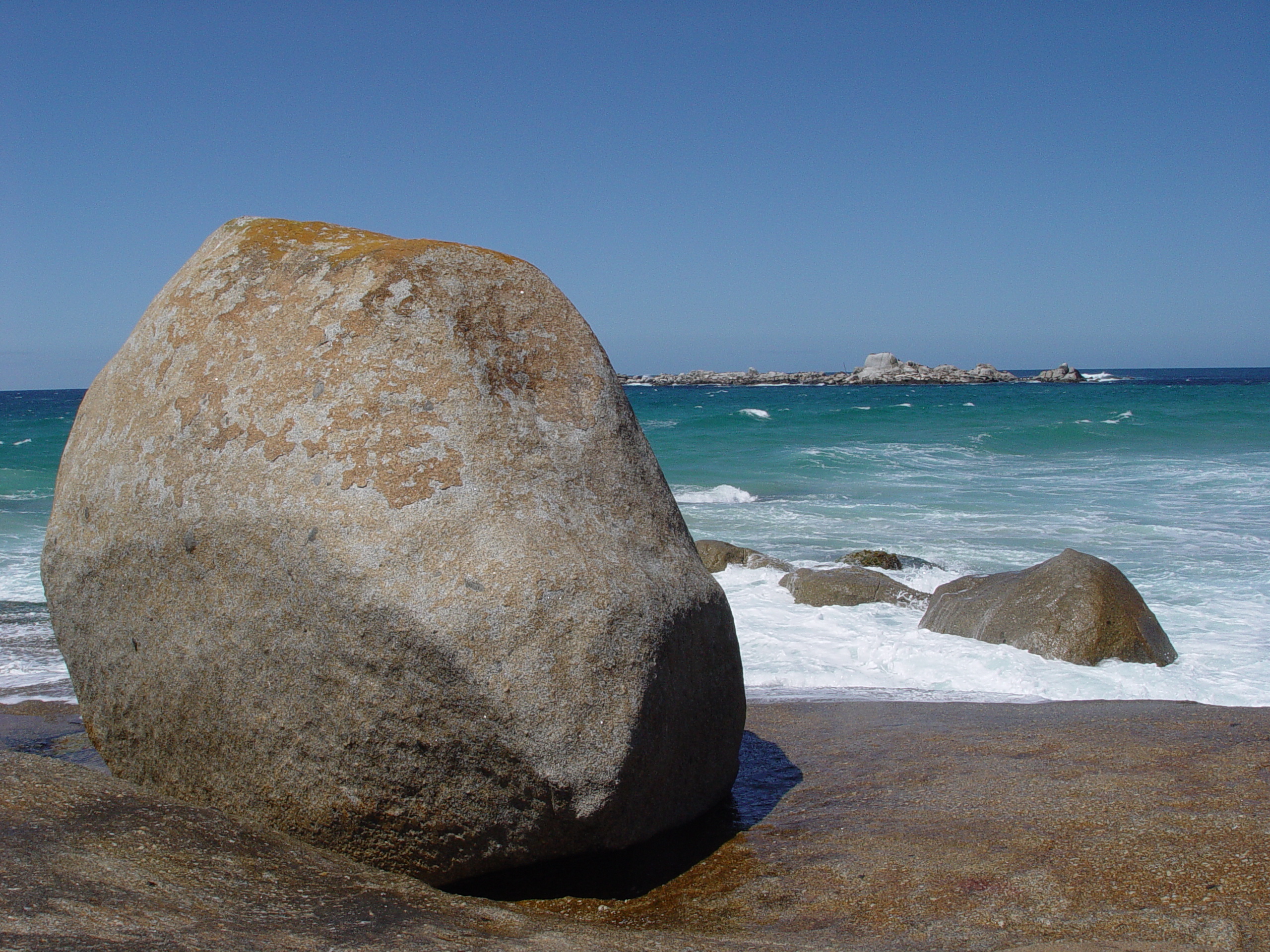
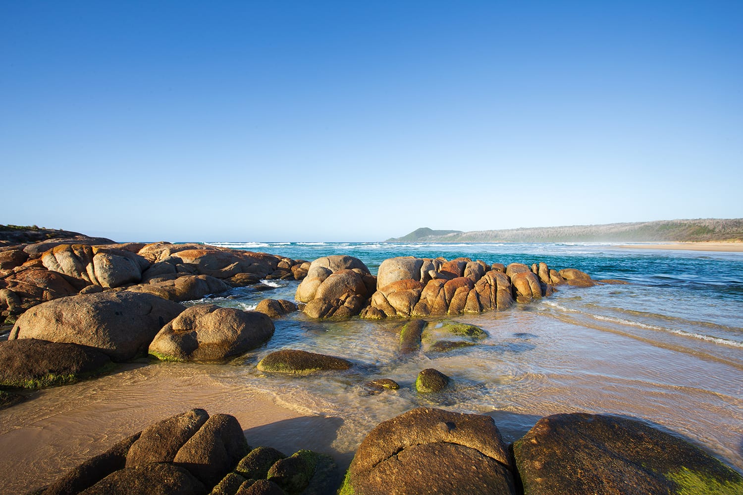
    Wingan Inlet’s ocean beach extends two kilometres from the western side of the entrance to Fly Cove. Just offshore from the entrance lies the Skerries, a granite island group that provides habitat for Little Penguins and many other seabirds and the Australian Fur Seal. The seals are often seen lazing on the rocks on the eastern side of the entrance.

    The Skerries

    In the campground, on still nights, the seals can be heard bellowing and on occasions their stench can drift ashore on a southeast breeze. 

    The ocean beach can also be reached from the campground, a four kilometre return walk. After leaving the Bloodwood forest surrounding the campground, the walking track follows the inlet shoreline on a raised boardwalk through a dense paperbark forest containing Scented Paperbark (Melaleuca squarrosa) and Swamp Paperbark (Melaleuca ericifolia). 

    Closer to the beach, Southern Mahogany (Eucalyptus botryoides) provide the canopy cover and Wild Cherry (Exocarpos cupressiformis), which produce small,  delicious fruit,  are common in the understory. In the summer months the magnificent  pink  Hyacinth Orchids (Dipodium punctatum) are often seen at the foot of the Southern Mahoganys. 

    Grass Trigger Plant – Stylidium graminifolium

    The ocean beach is a different and exposed environment. To the west is a short walk to Fly Cove and further two kilometres to the trig point on top of Rame Head. Here, to the north and west, lie ancient sand dunes, blown inland during ice age periods. 

    Looking at this natural landscape it is difficult to visualise the changes that have occurred over time, and yet it was only a matter of a few thousand years ago that the seas were much lower and vast amounts of sand were being deposited in longitudinal dunes oriented northeast-southwest. 

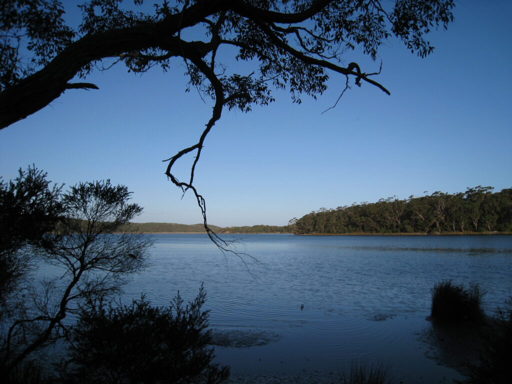
    The dunes trapped water flowing from inland, most likely creating a barrier across the Wingan River at some time. A similar natural process occurs today at Point Hicks where massive sand dunes deposit sand into the Thurra River which is then washed out to sea. Lake Elusive, accessed from the West Wingan Road not far from the campground, is a freshwater lake trapped between two sand dunes. 

    The Bidawal people (also known as Bidhawal and Bidwell) and their ancestors, the First Nations people of this country, have experienced these significant landscape changes during the fall and rise of sea level. On the shores of the inlet and on the rocky coastal headlands middens and cutting implements have accumulated from the thousands of years of occupation of this country by the Bidawal. 

    Wingan Inlet continues to be a place of great significance for its natural and cultural values and as a destination for  those seeking natural beauty and solitude. The journey down the West Wingan Road provides the rare opportunity to explore an environment rich in diversity and experience and appreciate this unspoilt landscape. 

    Note: Wingan Inlet is remote from facilities and services, the closest being located at Cann River.  The Parks Victoria website provides excellent information that assists visitors in planning their camping trip to this extraordinary part of East Gippsland (https://www.parks.vic.gov.au/places-to-see/parks/croajingolong-national-park/where-to-stay/wingan-inlet-campground).

  • A broken landscape –  impacts of  logging in the Wingan Inlet area

    A broken landscape –  impacts of logging in the Wingan Inlet area

    The bush northwest of Wingan Inlet in Croajingolong National Park now consists mostly of spindly Silvertop Ash (E. sieberi) stems, some dead, others struggling to recover from the massive 2019-20 fire. 

    These areas were logged for hardwood in the 1970s using a clear-fell technique that involved falling the majority of trees and leaving a few large trees to provide seed for regeneration. In the following autumn the logged areas, or coupes, were burnt to reduce the logging residue and encourage the release of seed from the few remaining trees.

    The resulting Silvertop Ash revegetation was prolific. Foresters at the time believed that a healthy forest would regrow and that timber would be ready for harvest in fifty to eighty years. What eventuated was a dense forest dominated by Silvertop Ash saplings competing for space, light and nutrients. These conditions provided little opportunity for trees to form a canopy. Other tree species that were common in the area prior to logging, such as Yellow Stringybark (E. muelleriana)  were mostly out-competed by the Silvertop Ash and the potential for the development of an understorey of shrubs and ground plants was limited. 

    In 1979 logged areas were included in the Croajingolong National Park, along with the country immediately surrounding Wingan Inlet that had been protected as a national park since 1909. 

    In January 1983 the Cann River Fire was ignited by lightning in the Bondi Forest area in NSW and by late March had burnt through to Mallacoota. The quantity and arrangement of fire fuel within the logged areas, along with extraordinarily dry conditions, resulted in extreme fire behaviour, killing and damaging the young Silvertop Ash saplings. 

    There was discussion at the time that the fire may have assisted in thinning out the dense regeneration, but there was sufficient seed available to germinate more regrowth. 

    Over the following decades, other than some planned burns, the logged areas experienced little or no fire activity. The Silvertop Ash saplings grew, but at a rate far less than was expected by the foresters back in the 1970s. With each sapling competing for space there was minimal canopy establishment. 

    The logged areas needed many decades without significant impacts to develop into mature forest. The massive fires that raged through eastern Australia in 2019-20 ensured that this was not going to happen and the landscape was again reduced to kilometre after kilometre of blackened, dead stems. After almost 50 years since the original logging, the regeneration process commenced once again. 

    Half a century later – area north of Wingan Inlet logged in early 1970s

    It is fortunate that the former Wingan Inlet National Park surrounding the inlet was protected from logging, although in the 1970s the foresters were keen to log up to the park boundary where possible.  Most of this area was also burnt in the 2019-20 fire and it now provides the opportunity to compare fire impacts between the logged and undisturbed areas.

    Within these unlogged areas much of the mature canopy was also burnt. While some of the canopy appears to have been killed, new epicormic growth indicates that much of the canopy is regrowing and will be re-established. The new canopy will, in turn, reduce light reaching the ground, slowing the regrowth at this level. Less light and cooler conditions under the canopy will increase humidity and ground moisture, encouraging plants requiring these conditions.

    Further from the logged areas and closer to the inlet, fire impacts in the mature forests are varied. Here the bush is more diverse with a greater occurrence of Mountain Grey Gum (E. cypellocarpa). Much of the canopy along the ridge tops was damaged, but is showing signs of recovery. In the gullies and rainforests, which also burnt in the extremely dry conditions, there has been damage to the canopy. Kanookas (Tristaniopsis laurina) are producing epicormic shoots, treeferns are resprouting fronds and  liane vines are re-establishing over the canopy. 

    There are rare patches of mature forest near the damper gullies that show little evidence of fire. These may be a result of fire behaviour at the time and need closer investigation to understand how they could have escaped the inferno. 

    In the sandy soils closer to the coast and on the west side of the inlet a magnificent forest of mature Red Bloodwood (Corymbia gummifera) provides valuable habitat for a range of fauna including the Yellow-bellied Glider and Greater Glider. The fire in this area burnt hot enough to kill the understory of Blue Olive Berry (Elaeocarpus reticulatus) and damage the Bloodwood canopy, but recovery is well underway. 

    Unlike the logged Silvertop Ash forests, the post fire regeneration of the understorey in the mature Red Bloodwood forest has produced a diversity of species. There are other comparisons with the logged areas, such as the presence of wildlife, including Lyrebirds scratching through the leaf litter and  Yellow-bellied Gliders screeching as they glide from tree to tree. In the burnt, logged areas there is only an eerie silence. 

    The Wingan Inlet area, where logged areas adjoin undisturbed national park, offers the opportunity to better understand the relationship between logged coupes and fire behaviour and why clear felling has failed to regenerate a healthy, diverse forest.

    The complete loss of canopy cover and the increase in light and heat at the forest floor are the most obvious impacts of the clear felling process.  The removal of vegetation and subsequent coup burn is a dramatic contrast to the natural process that occurs in the mature Silvertop Ash forest, which involves the germination of new vegetation  from the death of a single tree created from an opening in the canopy, allowing regeneration in the immediate area below. 

    The massive fires in 1982-83 and 2019-20 demonstrated that the arrangement and structure of fire fuels in the logged areas contributed to extreme fire behaviour. The dense forest of young saplings readily carried crown fire through the landscape.

    There was the opportunity in the 1970’s to employ selective logging practices that imitated the natural forest processes. However, this approach could not produce the quantity of logs required to satisfy the demands of the timber industry. Consequently the supply of logs ran out and sawmilling in the district collapsed. 

    The foresters who managed the clear felling process in the 1970s would be disappointed with spindly and dead Silvertop Ash stems that now dominate the landscape in the clear felled areas.   The promise of a thriving, new forest has not been realised. 

  • One hundred years of protection for Wingan Inlet – written in 2009

    One hundred years of protection for Wingan Inlet – written in 2009

    This year marks one hundred years since the establishment of Wingan Inlet National Park in Far East Gippsland. In October 1909 an area of 4560 acres (1890 ha), including the Skerries Rocks, was temporarily reserved as a national park following a deputation from the National Parks Association to the Minister for Lands.

    The protected area was established one mile (1.6 km) from the shoreline around the tidal section of the inlet. Despite later representations from the National Parks Association, the temporary reservation was not made permanent until the formation of the National Parks Authority in 1956 and the National Parks Act (1956) came into effect.

    Wingan Inlet is one of the few undeveloped estuaries in south eastern Australia and a favourite camping spot for people seeking a remote and quiet destination. This remarkable place combines so many different elements: a rocky offshore island group, exposed coastal headlands and heath lands, coastal forests, warm temperate rainforests and the tidal inlet itself.

    In the middens along this section of coast there is a history of thousands of years of occupation by Aboriginal people. Wingan Inlet was a rich hunting ground for Australian Fur Seals, fish and shell fish, and the surrounding forests provided an abundance of edible plants.

    The vegetation of this region is similar to that of the NSW south coast and many plants are at the extremities of their range here.

    In the damp gullies running into the inlet, areas of “jungle”, or warm temperate rainforests, Kanooka and Lilly-pilly draped with a canopy of vines shield an understorey of ground ferns. On the ancient sand dune ridges west of the inlet Red Bloodwood, Corymbia gummifera, is at the southern extremity of its occurrence. Classified as vulnerable in Victoria, the giant trigger-plant, Stylidium laricifolium, occurs at Wingan Inlet.

    The first recorded European to land at Wingan Inlet was George Bass who sheltered from rough seas in Fly Cove for nine days in December 1797.  It is probable that sealers called here in the 1800’s as the Skerries would have provided a good source of seals.

    After its reservation in 1909, the protection of the new national park was in name only as there was little on ground management. However, there is evidence of people visiting Wingan Inlet and some stopping for lengthy periods. Remains at a small hut site at the entrance of the inlet indicate that this site was used in the 1920’s and there are anecdotal reports of a hut site on the west side of the inlet being occupied in the 1930’s.

    During the war years, in the early 1940’s, a large fishing operation was based on the eastern side of the inlet. A massive school of Australian Salmon was penned in behind a wire mesh fence across the lower end of the inlet and tons of salmon were netted, loaded onto a barge, unloaded at a landing just off the East Wingan Track, and transported in boxes to Eden. Some remains of the landing can still be located today. Access to the East Wingan was difficult and the operation was relocated to the west side of the inlet. Not long after, heavy rains and flood waters swept the wire mesh fence and salmon out to sea.

    Visitation to the inlet increased following the war. After an inspection by the National Parks Authority in May, 1959, provision was made for the disposal of campers’ rubbish, and toilet units were constructed in the campground.

    In 1964 Ranger Ken Morrison, was appointed to look after Lind, Alfred and Wingan Inlet National Parks, in addition to the Mallacoota Inlet National Park, where he was based.

    Over the next few years Ken carried out basic improvements to the campground facilities, constructed a new walking track to the beach, and supervised works on the access road. His responsibilities over the four national parks meant that his efforts were thinly spread, making it difficult to deal with reports of wanton shooting of seals on the Skerries Rocks, increased vandalism and rubbish dumping. 

    A full time Ranger in Charge, Ray Maguire, was appointed to Wingan Inlet in 1975, and with the assistance of a Rural Employment Scheme, he carried out significant improvements to the campground, constructed a board walk on the walking track to the beach, and replaced a new jetty that was destroyed by floods.

    The creation of Croajingolong National Park in April 1979 brought an increased level of protection to a much larger area, and a greater level of staffing and resources.

    Today the gravel access road to the inlet from the Princes Highway is trafficable for two-wheel drive vehicles, but it can be rough and slippery in wet conditions. A kayak or small dinghy is perfect for exploring the estuary where, from the water, the only sign of development is a small jetty adjacent to the campground. Camping amongst the large Bloodwoods at in the campground is a special experience. At daytime, Wonga Pigeons and Lyre Birds can be seen scratching around campsites, while at night campers can listen to the screeching of Yellow-bellied Gliders and the bellowing of seals on the Skerries.

    Fortunately this remarkable place remains as unspoilt as when it was reserved one hundred years ago.

    Graham Parkes worked at Wingan Inlet and Croajingolong National Parks from 1976 to 1982, and is currently Ranger In Charge of the Grampians National Park.

  • The Story of the Wingan Salmon

    The Story of the Wingan Salmon

    Lichen now covers the granite rocks at the Fishermans Landing at Wingan Inlet, Croajingolong National Park. The surrounding vegetation has regrown and there is little to indicate the role that this site played in the Second World War.

    Following the commencement of war it was a priority of the Federal Government to secure sources of protein for troop rations for the Australian forces and canneries at Narooma and Eden were contracted to produce canned fish, mainly tuna and salmon. 

    In 1941 there were reports of a massive shoal of Australian Salmon (Arripis trutta) in Wingan Inlet.  The general manager of the Narooma Fish Canning Pty Ltd reported that “40 acres of salmon, equal to between 5,000,000 and 6,000,000 cans are waiting to be caught”.

    Netting the fish was going to be a major undertaking, involving the construction of vehicle access to the remote estuary. While the cannery at Eden was preparing to receive the fish, heavy rains washed the salmon out to sea before any road building or fishing operations could commence.

    The following winter Wingan Inlet was again full of salmon.

    A number of Eden fishermen, including Norm Joiner and his father Ned, saw the opportunity to supply fish to the Eden cannery. The Joiners were experienced in fishing salmon in the local waters around Eden and Womboyn Lake.

    On 22 July 1942 the fishermen constructed a wire netting fence across the lower part of Wingan Inlet, penning an estimated 100,000 boxes of salmon, each box potentially holding 70 lbs (32 kg).


    Jack Symonds (L) and Norm Joiner (R) repairing the salmon wire netting fence at Wingan Inlet 1942

    To transport the catch, vehicle access from the Princes Highway to the inlet was urgently needed.

    Ned Joiner, with the assistance of a local cattleman, identified and blazed the shortest and most trafficable route from the Wingan River bridge on the highway to the deepest water suitable for a  landing on the eastern side of the inlet, a distance of about 25 kilometres.

    Ned and his team set to work clearing a track and constructing several culverts, corduroy crossings and a significant bridge across the Hard To Seek Creek, all without the assistance of government funding and completed in three weeks.

    At the Fishermans Landing the Joiners built a small wharf using local split timbers and erected a crane powered through the rear differential of a Willys Overland. They were an innovative family who could readily adapt to working is these remote conditions.


    Norm Joiner and 5 ton truck on the Fishermans Landing, Wingan Inlet 1942

    Norm Joiner commenced netting, delivering the salmon by barge to the Fishermans Landing and loading and transporting the boxes to Eden on a 5 ton truck. On 6 September 1942 the first two loads of salmon were carted to the cannery for which the fishermen received two shillings and sixpence per box.

    Over the following weeks about 4,000 boxes of fish were netted and transported.

    With the success of the operation and interest in the fishery by Victorian fishermen, funding was provided to construct alternative access to the western side of the inlet, allowing quicker access to the Melbourne market. It is likely that the current West Wingan Road largely follows this alignment.

    Wet conditions on the eastern road resulted in the relocation of the Joiner operation to western side in early November 1942. Unfortunately the new road was also problematic in wet conditions, sometimes resulting in trucks needing to be pulled by a tractor.  

    On 21 November it started to rain and by 24 November 14 inches (350 mm) had fallen, causing the inlet to flood. Fence and salmon were washed out to sea and the fishery ceased. In total, 8,000 boxes of salmon were netted and transported for canning.

    Norm Joiner returned to fishing and carting timber around Eden, raising a family and contributing to the local community. Passionate about the fishing industry, Norm wrote in 1979 of the decline of the salmon numbers due to larger boats and the use of spotter planes, advocating a closed salmon season for south east Australia.

    Wingan Inlet today remains a remarkable, natural place, one of the few undeveloped estuaries in south eastern Australia and a favourite spot for people seeking a remote and quiet destination.

    Acknowledgements: Thank you to Fay Switzer (daughter of Norm Joiner) and the Joiner family for use of photos and documents and the Eden Killer Whale Museum for copies of various articles. Background information was also gained from a 1943 letter to the Eden Magnet and Pambula Voice by Jonas Crabtree, recopied by Joanne Korner in 2016.

  • Wingan Inlet’s Sydney Rock Oysters

    Wingan Inlet’s Sydney Rock Oysters

    Wingan Inlet in Far East Gippsland provides ideal habitat for a famous Australian shellfish, the Sydney Rock Oyster (Saccostrea glomerata). Found in clusters around the shoreline and firmly attached to the granite rocks, this mollusc is well adapted to the twice daily inundation, extremes of hot and cold and variable currents found within the estuary’s intertidal zone.   

    The Sydney Rock Oyster is endemic to the Australian east coast and has a range that extends from Wingan Inlet in Victoria’s Croajingolong National Park to Hervey Bay in Queensland. It reaches maturity at three years and has a life span of 10 years.

    For First Nations people, Sydney Rock Oysters provided a sustainable food source, easily carried and remaining fresh out of the water for up to three weeks in cool conditions. The shells were utilized in tool making and evidence of their widespread use and consumption can be found in the large mounds or middens located along the east coast.

    First Nations people also harvested the southern mud oyster or Australian flat oyster (Ostrea angasi), endemic to southern Australian estuaries.   It is larger than the Sydney Rock Oyster, but less common at Wingan Inlet.

    The Sydney Rock Oyster is not only valuable as a food source. Being hardy and difficult to dislodge, the clusters of oysters protect estuary shorelines by lessening the erosion impact of waves and currents.

    The structure of the oyster clusters provides valuable habitat for fish, crustaceans, other molluscs and invertebrates.

    When the tide is in, oysters open up their two hinged shells to draw water across their gills and filter feed on phytoplankton or algae.  These tireless creatures are major contributors to the excellent water quality of the estuary.

    The abundance of oysters noted by European visitors to Wingan Inlet is testament to the thousands of years of sustainable management of the resource by the First Nations people.

    In 1869 William Turton, Assistant Geodetic Surveyor camped at Wingan Inlet and wrote that his party was without meat. He reported “One good thing is we have plenty of oysters, and could load ships with them. We manage to live on them now.”

    Lieutenant HJ Stanley, RN, reported following a coastal survey by MMS Pharos in 1871 that “The oysters found were very large and good, but not in sufficient quantity to create an industry, unless it were ever intended to form the inlet into a breeding place, for which it seems admirably adapted.”

    News of the Wingan Inlet oysters spread and in the 1880’s, fishermen were making the dangerous journey to the inlet to take the sought after shellfish for the NSW market. In 1886 the lighthouse keeper at Gabo Island, Mr Simpson, gave assistance to a man named Glover and his three mates who reached the lighthouse after being six days without any food, apart from a few oysters. Glover said that their boat grounded on the Wingan Inlet bar and only got off after a quantity of oysters had been thrown overboard. Several days later a second attempt to cross the bar and head to sea was made and, although the boat managed to get across, it was considerably battered. Repairs having been effected, the men rowed the thirty six miles (58 kilometers) up to their waists in water and greatly relieved to reach Gabo Island.

    In the late 1800’s there were reports that the supply of oysters from Wingan Inlet was considerably reduced due to the take by boat crews from New South Wales. Interest in establishing an oyster industry was growing and in 1900, Mr Mason, marine surveyor for the Commissioner of Customs, visited Wingan Inlet to assess its suitability for a lease for oyster cultivation. Mr Mason reported that the inlet was “eminently suitable for the cultivation of oysters, and that comparatively little expenditure would be needed to secure good returns.”

    In the early 1900’s there is little information that describes any oyster cultivation activity at Wingan Inlet, other than in a 1901 report of the wreck of the Steamer Federal a mention of a man named Anderson camped at Wingan Inlet and in charge of the oyster beds.

     “The Wingan River, A Gem of the Victorian Coast” by EJ (Edwin James) Brady in 1911 provides a detailed and entertaining account of a camping trip to Wingan Inlet and the consumption of local oysters.  Brady, with his mate, Charlie Cameron from Double Creek, rode the coastal route from Mallacoota and camped, fished, hunted and swam over three days. While his mate was looking for a lost horse, Brady devoted himself to photography and eating, writing “Wingan oysters are justly regarded …. as second to none”.

    The quality of the Wingan Inlet oysters was also noted by Lieutenant-Colonel  JM  Semmens, Inspector of Fisheries and Game during his inspection of the oyster beds in 1919. He was “very much impressed with the possibilities of the extension of the Wingan rock oyster beds by proper culture”. He went on to describe the oysters as “the finest in Australia and most of them are in beautiful condition”. Lieutenant Colonel Semmens’ journey to the inlet was not easy, requiring a pack horse with a guide and a day in the saddle.

    Recommendations to the Fisheries and Game Department following Lieutenant Colonel Semmens’ visit reinforce the enthusiasm for developing the oyster fishery within Victoria after the First World War. And there was great praise for the Wingan Inlet oysters. “Indeed, it is doubtful whether more palatable rock oysters exist in any part of the world” commented the Melbourne Herald at the time.

    The arrangements for transporting the Wingan Inlet oysters were arduous, involving a boat trip to Cunninghame (now Lakes Entrance), a steamer trip to Bairnsdale and the journey completed by train to the Melbourne Market.

    Interstate rivalry was a factor in the plans to develop Victoria’s oyster fishery after the First World War. When the Minister for Fisheries, Dr Stanley Argyle, visited Wingan Inlet in 1924, he did not see why Victoria should not emulate New South Wales in the cultivation of the oyster. Dr Argyle said that if he had his way, the New South Wales growers who had the run of the Melbourne market would have to meet competition from a little closer to home.

    In 1928, in spite of the great acclaim the Wingan Inlet oysters received, it was becoming clear that there were challenges in their cultivation. An investigation by TC Roughley, economic zoologist of the Technological Museum, Sydney found that it was hard to remove the oysters from the hard granite rock without substantially damage. He recommended the use of mangrove sticks that could be easily transported to the inlet and laid out to grow the oysters.   This technique was used elsewhere in NSW and described by TC Roughley’s in 1925 in “The Story of the Oyster”.

    Following a tender process in 1929, the Fisheries and Game Department received four applications for licences for intensive oyster cultivation at Wingan Inlet. This came at a time when the oysters were depleted and it was recognised that it would take some years before marketable quantity would be available for the Melbourne market.

    The Chief Inspector of Fisheries and Games, Mr Lewis, together with the Chief Secretary, Mr McFarlane made an inspection of the oyster culture areas in 1934 and said that it would be possible for all of Melbourne to be supplied with oysters from Wingan Inlet. Ten leases had passed the experimental stage and were flourishing.

    The recovery of the inlet’s oysters was short lived due to heavy rains in 1937 reducing salt water levels, causing undernourishment and mortality.  A proclamation prohibiting the taking of oysters was introduced, and the sole lessees, Warn and Boller halted taking out the recovering oysters.

    In 1952 the Weekly Times lamented that Wingan Inlet oysters, the “world’s finest”, farmed by New South Wales fishermen operating from just across the border,  no longer found their way to the Melbourne Market.

    Regardless of the efforts of and optimism shown by government officials, experts and politicians over the years, a sustainable oyster fishery was not achieved at Wingan Inlet. There was much discussion about practices for improving cultivation, such as the establishment additional oyster beds, but there is little evidence of this today.

    At some time a long row of oyster rocks were placed across the flats about 1.5 km from the inlet’s entrance. It is unclear whether these were positioned by the New South Wales oyster fishermen or earlier by First Nations people and their purpose and history requires further investigation.

    Over the last few decades the population of oysters around Wingan Inlet’s shoreline has re-established and continues to contribute to the health of this magnificent estuary. As the world’s climate changes, monitoring of this oyster population could provide a greater understanding of the impacts of rising temperatures and water acidity. With the increasing pressures on our natural systems, the need to protect this remarkable place takes on even greater importance.

    Acknowledgement: The information supporting this article was sourced from newspaper reports on https://trove.nla.gov.au/ and the recollections of many who have experienced and enjoyed Wingan Inlet over the years.