This year marks one hundred years since the establishment of Wingan Inlet National Park in Far East Gippsland. In October 1909 an area of 4560 acres (1890 ha), including the Skerries Rocks, was temporarily reserved as a national park following a deputation from the National Parks Association to the Minister for Lands.
The protected area was established one mile (1.6 km) from the shoreline around the tidal section of the inlet. Despite later representations from the National Parks Association, the temporary reservation was not made permanent until the formation of the National Parks Authority in 1956 and the National Parks Act (1956) came into effect.
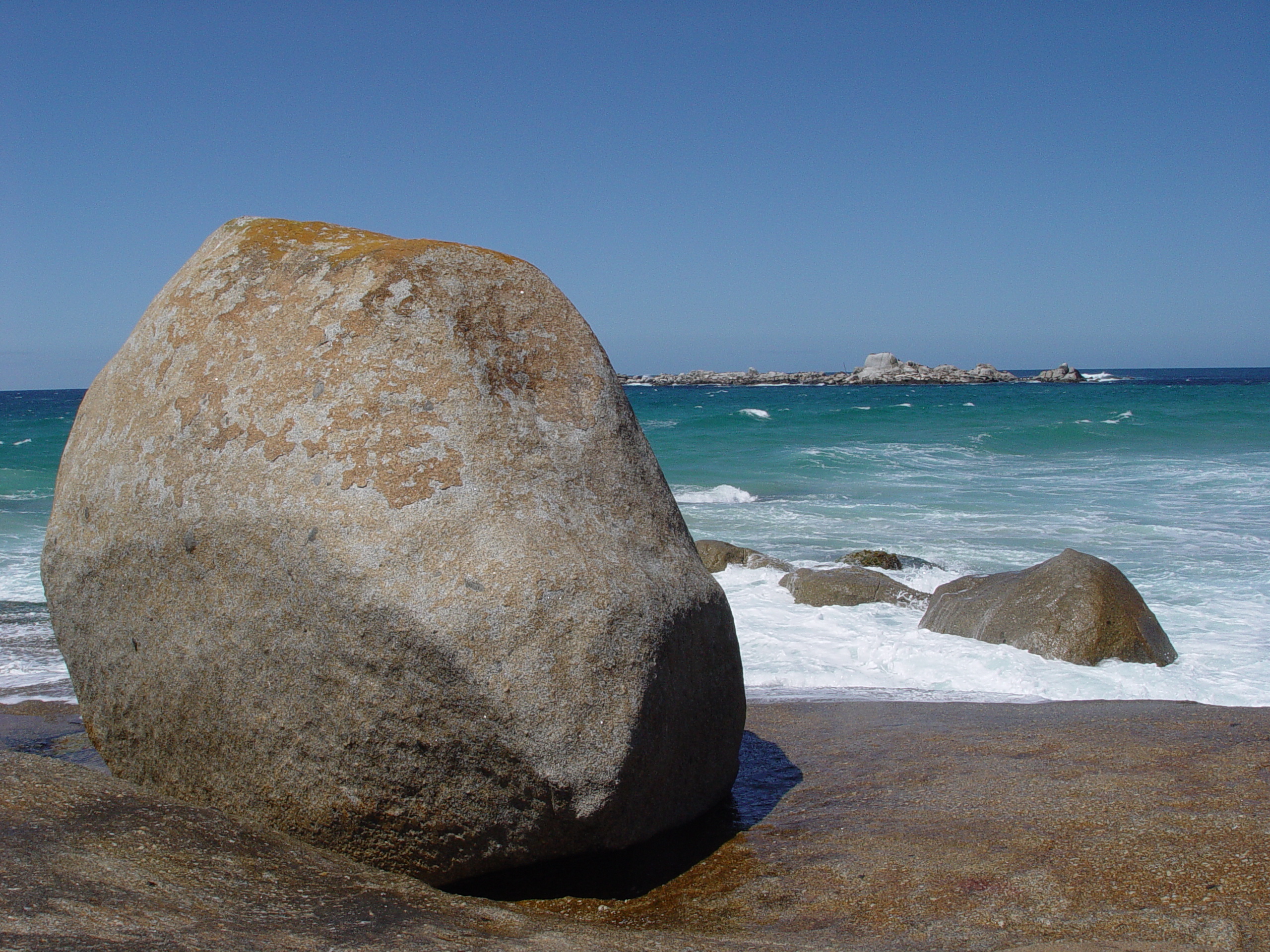
Wingan Inlet is one of the few undeveloped estuaries in south eastern Australia and a favourite camping spot for people seeking a remote and quiet destination. This remarkable place combines so many different elements: a rocky offshore island group, exposed coastal headlands and heath lands, coastal forests, warm temperate rainforests and the tidal inlet itself.
In the middens along this section of coast there is a history of thousands of years of occupation by Aboriginal people. Wingan Inlet was a rich hunting ground for Australian Fur Seals, fish and shell fish, and the surrounding forests provided an abundance of edible plants.
The vegetation of this region is similar to that of the NSW south coast and many plants are at the extremities of their range here.
In the damp gullies running into the inlet, areas of “jungle”, or warm temperate rainforests, Kanooka and Lilly-pilly draped with a canopy of vines shield an understorey of ground ferns. On the ancient sand dune ridges west of the inlet Red Bloodwood, Corymbia gummifera, is at the southern extremity of its occurrence. Classified as vulnerable in Victoria, the giant trigger-plant, Stylidium laricifolium, occurs at Wingan Inlet.
The first recorded European to land at Wingan Inlet was George Bass who sheltered from rough seas in Fly Cove for nine days in December 1797. It is probable that sealers called here in the 1800’s as the Skerries would have provided a good source of seals.
After its reservation in 1909, the protection of the new national park was in name only as there was little on ground management. However, there is evidence of people visiting Wingan Inlet and some stopping for lengthy periods. Remains at a small hut site at the entrance of the inlet indicate that this site was used in the 1920’s and there are anecdotal reports of a hut site on the west side of the inlet being occupied in the 1930’s.
During the war years, in the early 1940’s, a large fishing operation was based on the eastern side of the inlet. A massive school of Australian Salmon was penned in behind a wire mesh fence across the lower end of the inlet and tons of salmon were netted, loaded onto a barge, unloaded at a landing just off the East Wingan Track, and transported in boxes to Eden. Some remains of the landing can still be located today. Access to the East Wingan was difficult and the operation was relocated to the west side of the inlet. Not long after, heavy rains and flood waters swept the wire mesh fence and salmon out to sea.
Visitation to the inlet increased following the war. After an inspection by the National Parks Authority in May, 1959, provision was made for the disposal of campers’ rubbish, and toilet units were constructed in the campground.
In 1964 Ranger Ken Morrison, was appointed to look after Lind, Alfred and Wingan Inlet National Parks, in addition to the Mallacoota Inlet National Park, where he was based.
Over the next few years Ken carried out basic improvements to the campground facilities, constructed a new walking track to the beach, and supervised works on the access road. His responsibilities over the four national parks meant that his efforts were thinly spread, making it difficult to deal with reports of wanton shooting of seals on the Skerries Rocks, increased vandalism and rubbish dumping.
A full time Ranger in Charge, Ray Maguire, was appointed to Wingan Inlet in 1975, and with the assistance of a Rural Employment Scheme, he carried out significant improvements to the campground, constructed a board walk on the walking track to the beach, and replaced a new jetty that was destroyed by floods.
The creation of Croajingolong National Park in April 1979 brought an increased level of protection to a much larger area, and a greater level of staffing and resources.
Today the gravel access road to the inlet from the Princes Highway is trafficable for two-wheel drive vehicles, but it can be rough and slippery in wet conditions. A kayak or small dinghy is perfect for exploring the estuary where, from the water, the only sign of development is a small jetty adjacent to the campground. Camping amongst the large Bloodwoods at in the campground is a special experience. At daytime, Wonga Pigeons and Lyre Birds can be seen scratching around campsites, while at night campers can listen to the screeching of Yellow-bellied Gliders and the bellowing of seals on the Skerries.
Fortunately this remarkable place remains as unspoilt as when it was reserved one hundred years ago.
Graham Parkes worked at Wingan Inlet and Croajingolong National Parks from 1976 to 1982, and is currently Ranger In Charge of the Grampians National Park.
Leave a Reply